Our mission
We are developing a virtual 3D bike park platform with accurate trail maps (based on 3D scans) and detailed data (topography, dimensions). It offers cyclists safety, personalized routes, time savings, and interactive ride planning.
The solution of virtual 3D maps of bike park trails addresses several important needs of our target group, which includes active cyclists, biking enthusiasts, and people who value outdoor activities:
- Safety and confidence in the trail
- Personalized trail planning
- Convenience and time-saving
- Modern virtual experience
- Skill enhancement and off-track experience
- Promotion and marketing
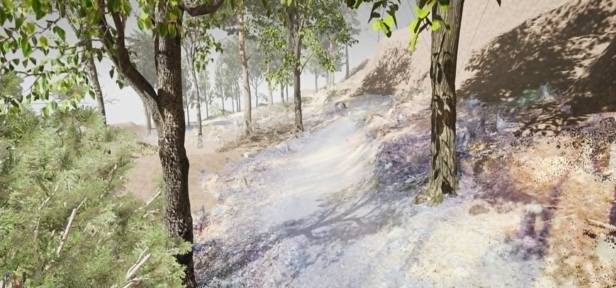
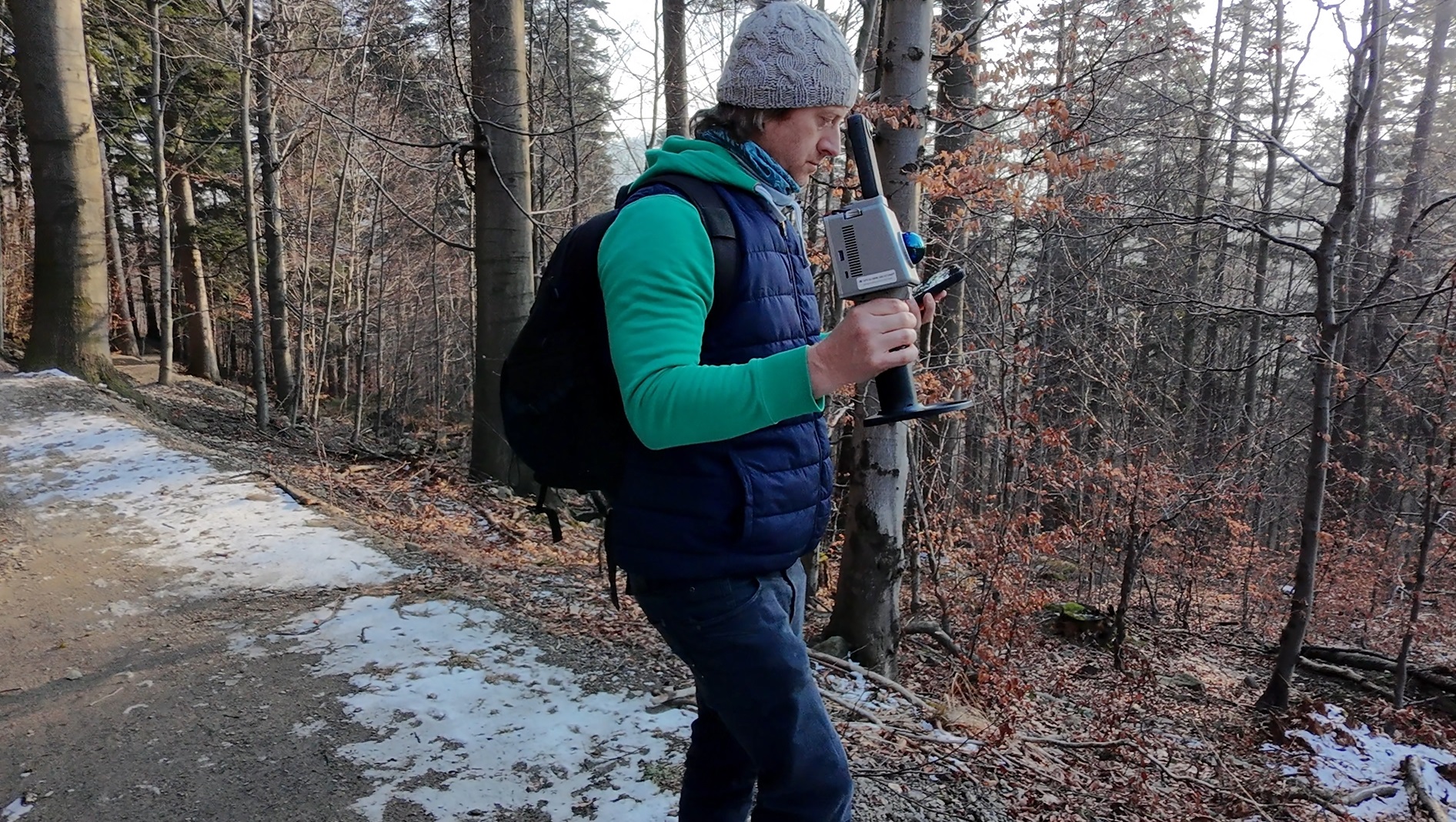
We perform three-dimensional measurements of paths using two methods
- SLAM Lidar Scanner.
- Photogrammetry
We perform measurements in order to collect complete, actual information about a given area.
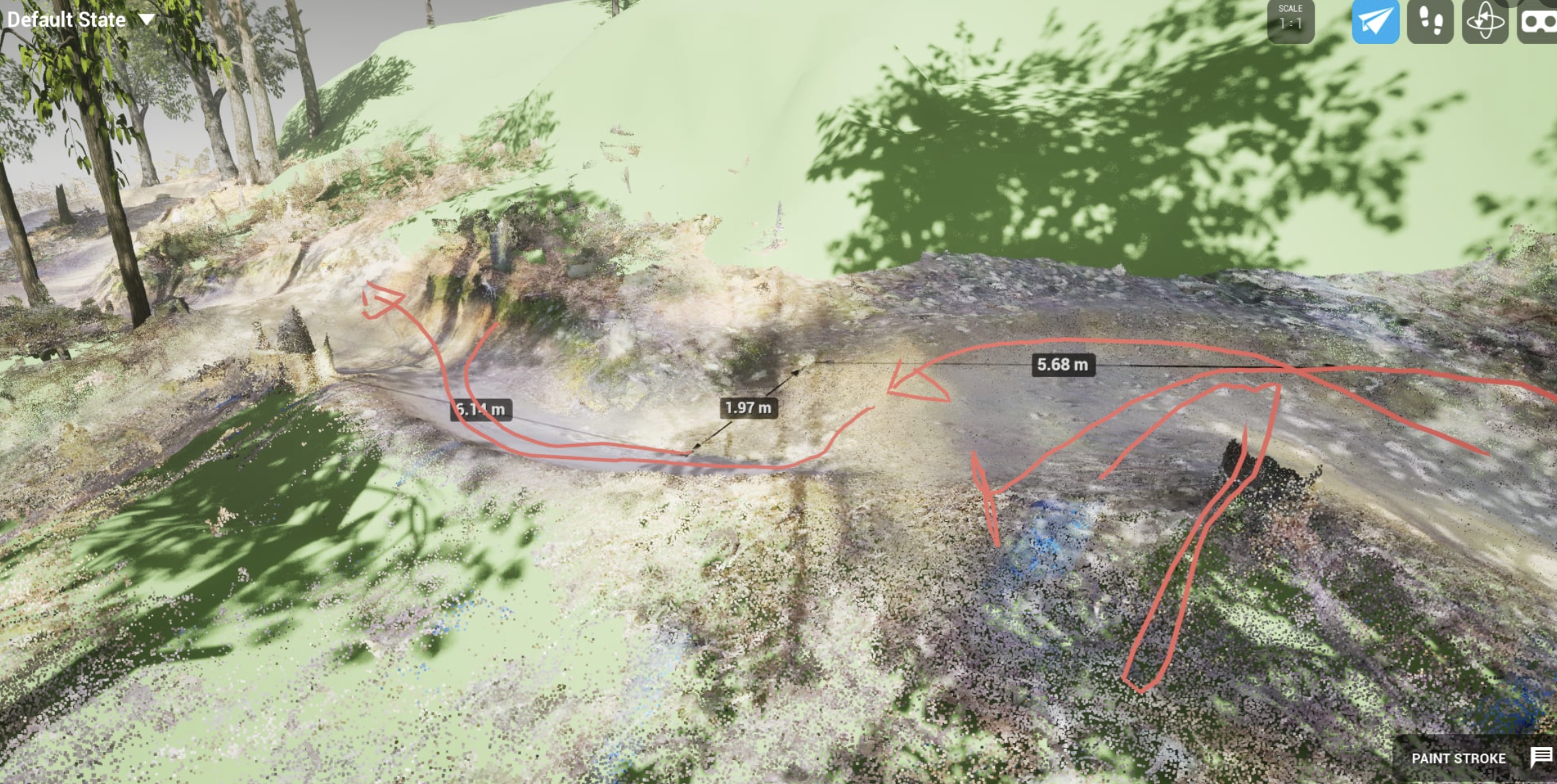
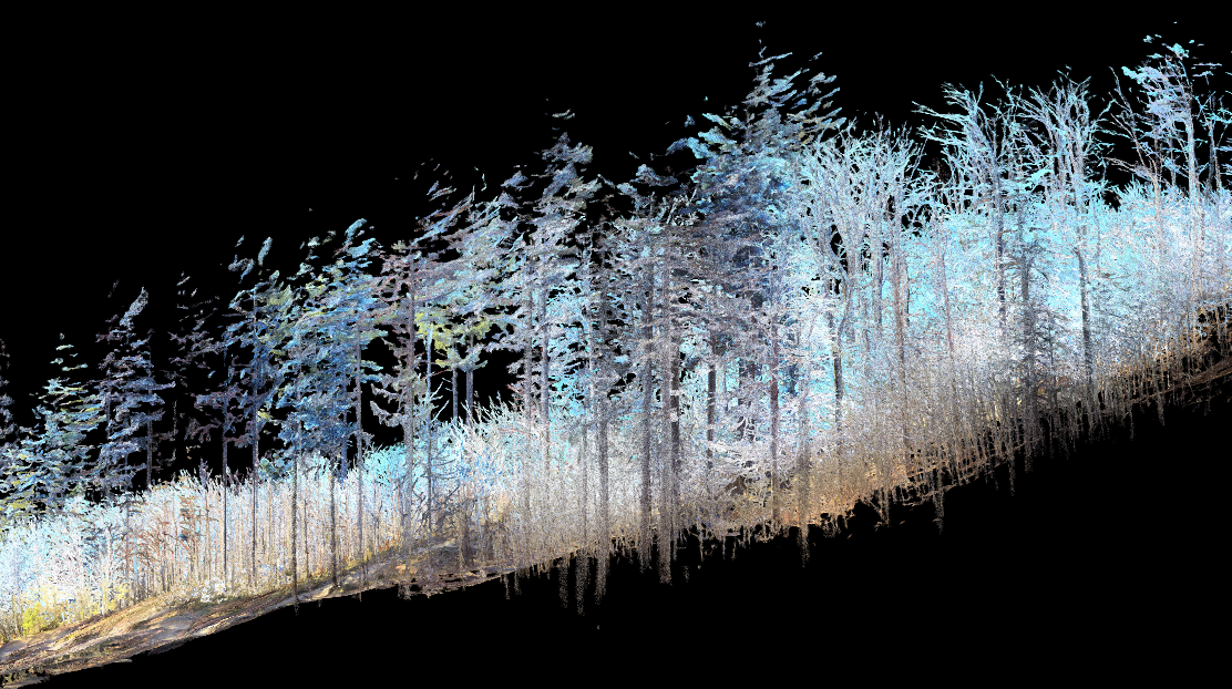
Field data processing
Thanks to the full analysis of the terrain, trees, we prepare data ready for further visualization. Data after measurement is automatically classified into terrain, trees and other objects.
The data obtained can be used for a full inventory and appropriate land development in order to properly manage the bike park area.
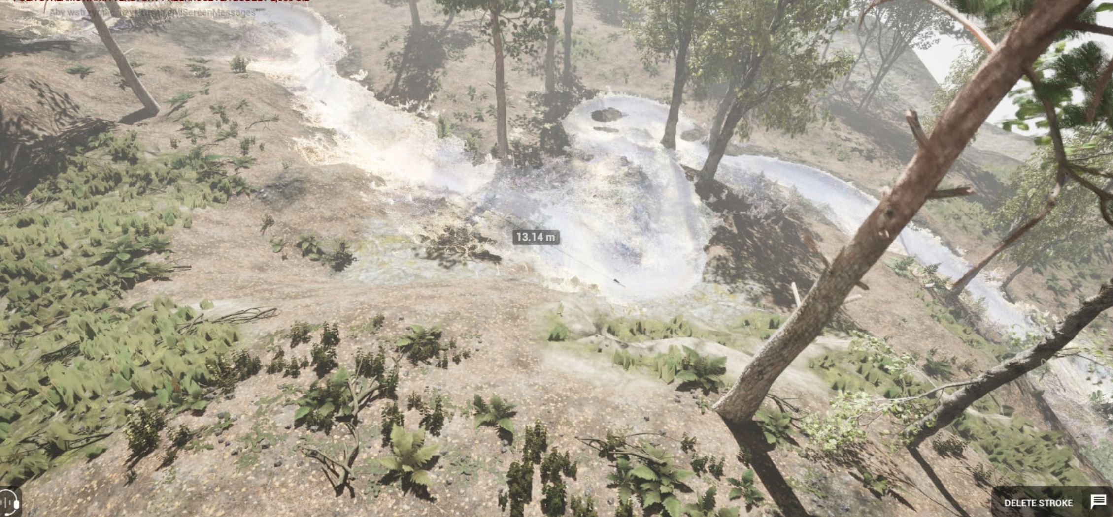
Virtual Bikepark in Unreal Engine 5
After processing the 3D data, we put it into Unreal Engine 5 and create a world in which you can:
- Walk along the paths of a given bike park and get to know the exact topography.
- Check what difficulties/pleasures we may encounter on a given path.
- Find out the exact dimensions, check if there is a driveway nearby, it will be fine
- Navigate by GPS coordinates.
Contact
Address
Ul. Juliana Fałata 124, 43-360 Bystra
Call Us
+48 797196359
Email Us
kontakt@immersivespace.pl